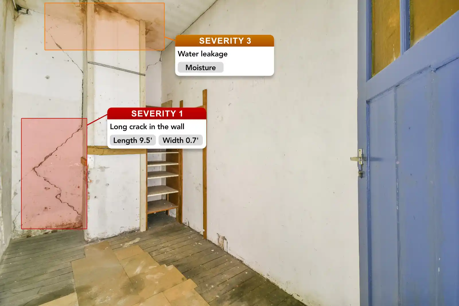
Indoor Inspection
Photogrammetry and Drone Inspection
Photogrammetry allows to obtain 3D measurements and reliable data on buildings, structures and land using photographs and stereoscopy. In addition, drone photogrammetry has several unique advantages for the environment, urban planning and architecture.
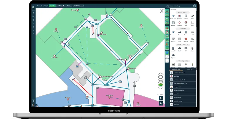
Indoor Mapping
Floor Plan Editor
Our Indoor Mapping software is the tool behind Wayfinding, Customer Journey, Wi-Fi Network Topology & Heatmaps. We offer an advanced indoor mapping system that regroup all your informations in one place. Perfect to share the latest up to date information with IT department, External Technicians and Operators (for renovations), Employees for Training, or even Building Inspectors.
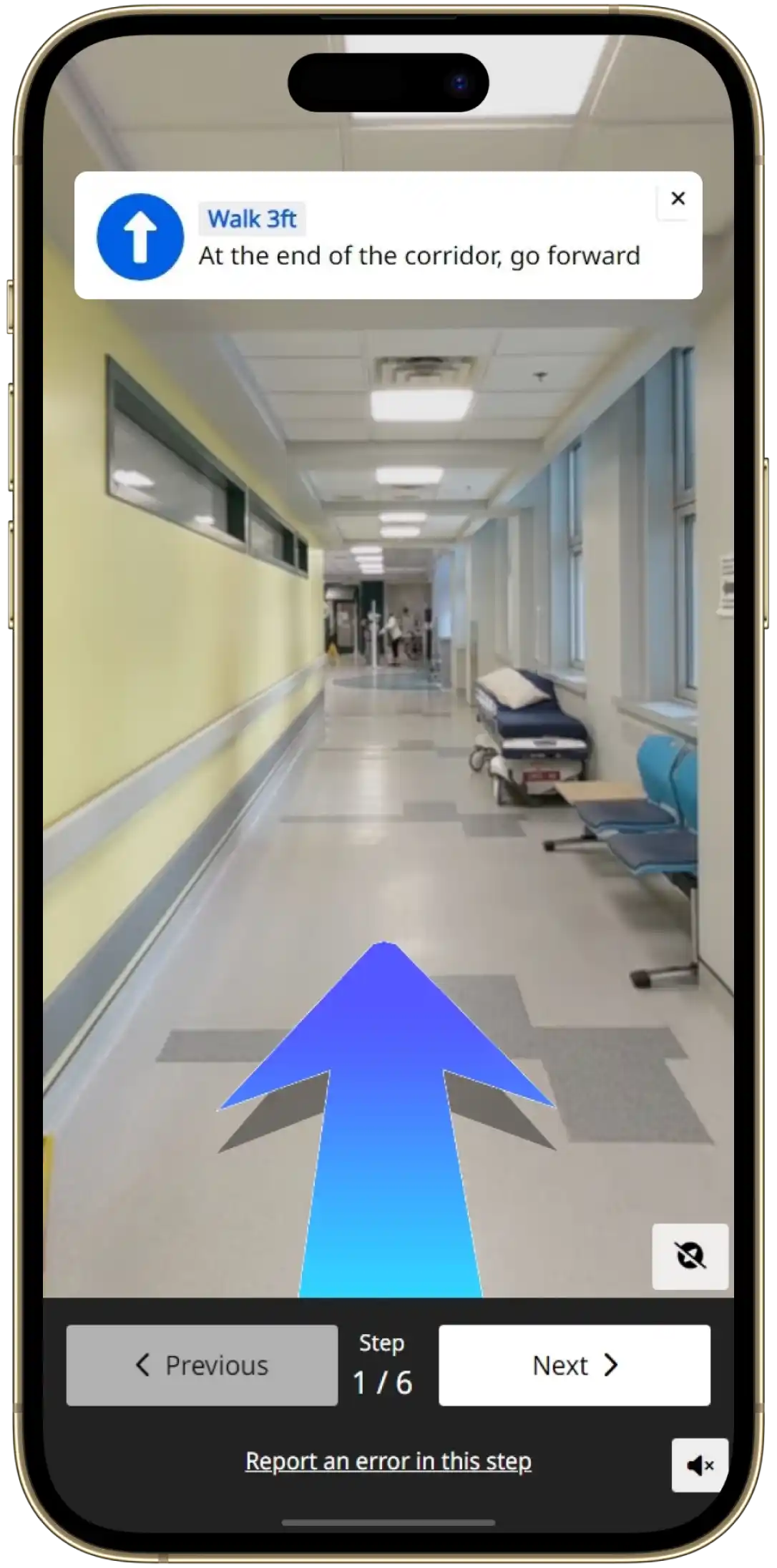
Heatmap & Customer Journey
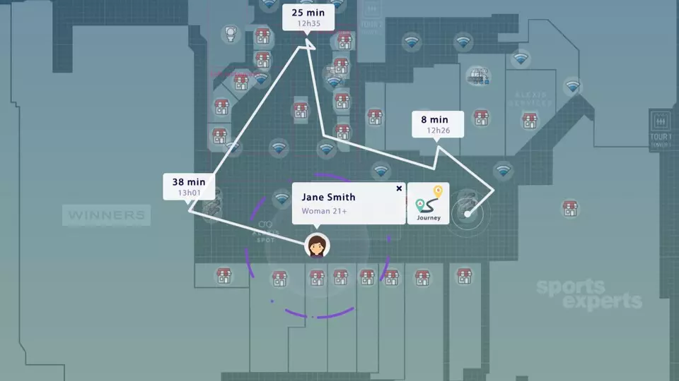
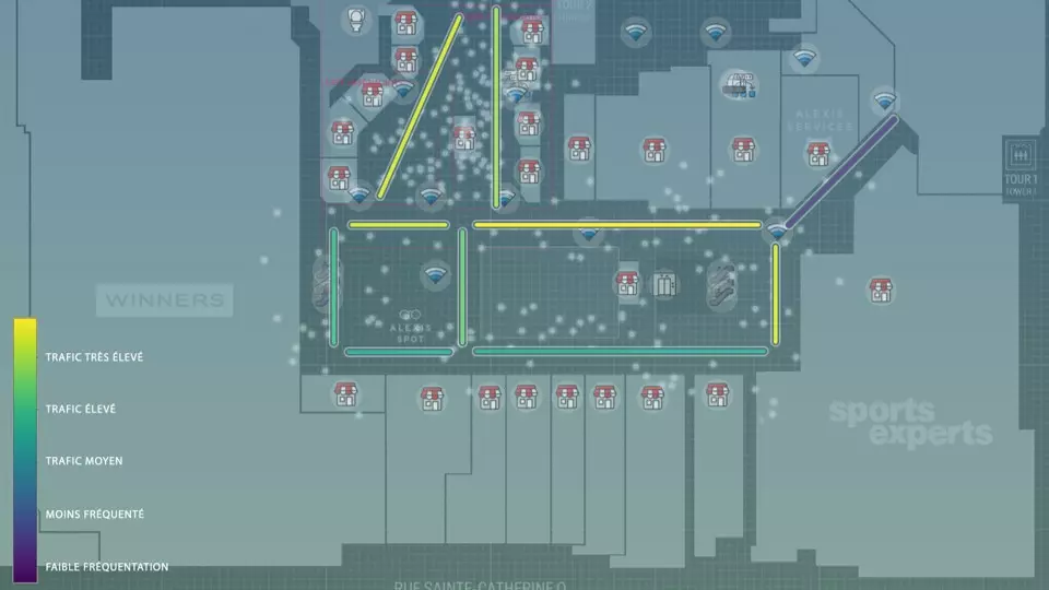
Combine powerful data with geolocation technology
Have more visibility on the habits and behaviors of your physical traffic: the number of visits, the time spent in your establishment, etc ...
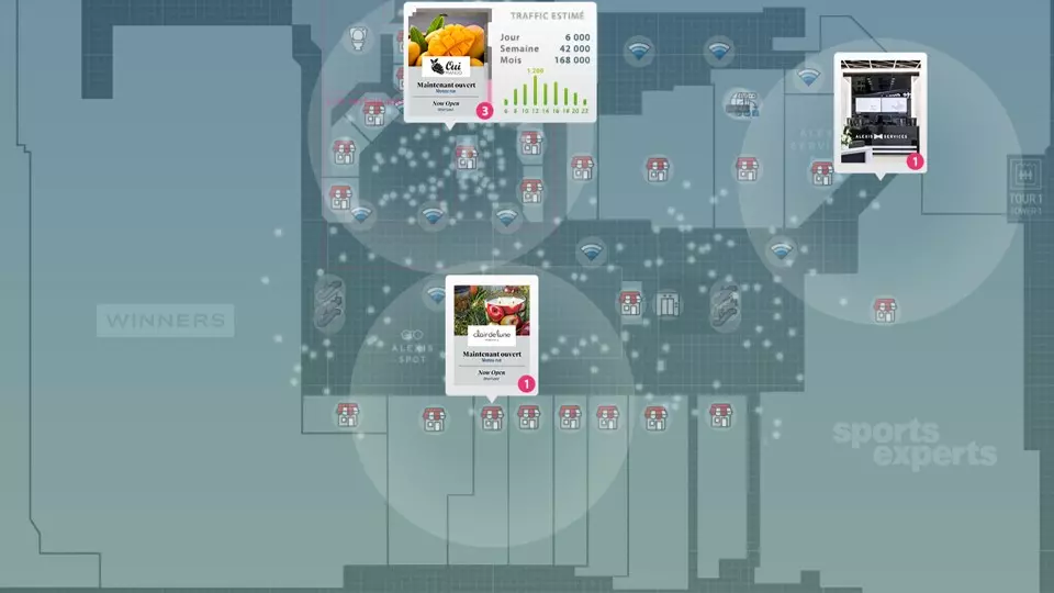
Analytics and Report
Discover what your customers are doing on site.
Budget management
Which areas have the most trafic? Optimize your store layout.
Geolocalised ads
Increase the effectiveness of your content, rent virtual advertising space to generate a direct ROI.